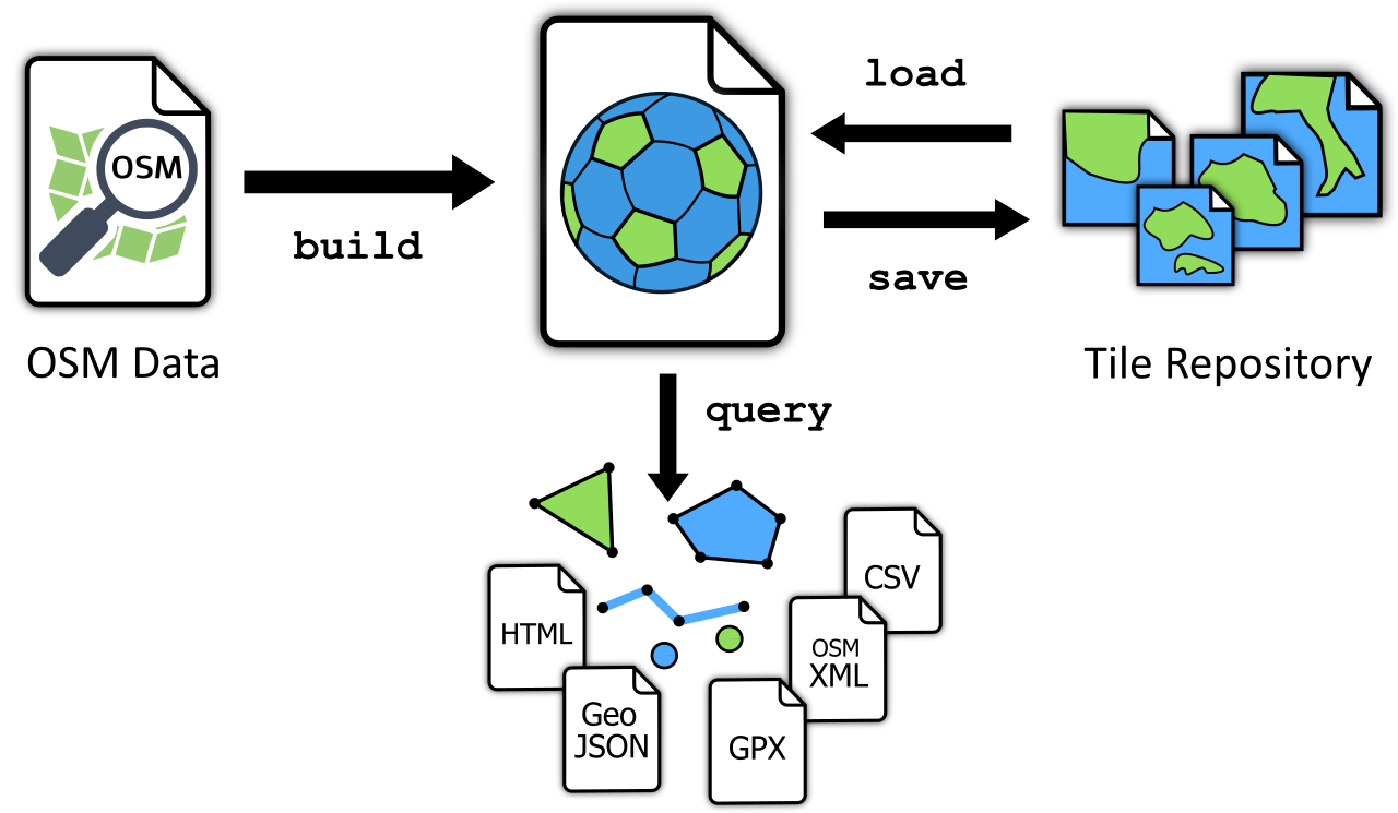
The GOL Tool
The gol (“Geo-Object Librarian”) command-line utility allows you to build, manage, and query Geo-Object Libraries and Bundles.
Most commands follow this form:
gol <command> <gol-file> [<arguments>] [<options>]
Commands
Create a Geo-Object Library from OpenStreetMap data. | |
Verifies a Library’s integrity. | |
Display documentation. | |
Provide basic file statistics. | |
Import tiles from a Bundle into a Library. | |
Display features on a map. | |
Retrieve features. | |
Writes tiles from a Library to a Bundle. |
On Windows, progress bars may appear ragged. To fix this, switch the shell’s font to Cascadia Mono (in
Properties) or another font with broad Unicode support (such as JetBrains Mono or Source Code Pro).
Common Options
The following options are supported across most commands:
-a, --area <COORDS> | <FILE>
Defines the (multi)polygon area to which the command should be applied. The following coordinate formats are supported:
GeoJSON
WKT
Raw coordinates in the form
lon_0, lat_0, ... , lon_n, lat_n. To specify multiple polygons, or a polygon with one or more “holes,” place each ring in parentheses. Rings do not need to be closed.
You can specify coordinate values directly, or via a file.
-b, --bbox <W>,<S>,<E>,<N>
Defines the rectangular area (bounding box) to which the command should be applied. Coordinates are specified in WGS-84 (degrees longitude and latitude) and take the form <west>,<south>,<east>,<north>. Coordinates must not be separated by spaces (otherwise, they would be interpreted as separate arguments).
As an alternative, this option accepts a tile descriptor in the form z/x/y.
-q, --quiet
Displays only minimal output. Apart from error messages, only minimal progress updates are written to stderr.
-s, --silent
No output at all is written to stderr, not even error messages. (Whether a command succeeded or failed can only be ascertained via the status code returned by the process).
-v, --verbose
Writes extra information to stderr.